

If you think the American landscape formed slowly through water and wind, think again. New geological evidence and advanced satellite imaging reveal a lost world of mega floods, immediate transformation, and destructive forces that resemble Hollywood blockbusters more than high school science. Forget slow erosion; consider the continental shock therapy that obliterated entire ecologies, topographies, and possibly forgotten civilizations buried under glacial debris.
This radical revision of American prehistory extends beyond classrooms, hinting at immense floods, concealed landscapes, and the catastrophic erasure of ancient human chapters. The clash between gradual change and explosive upheaval lies at the heart of modern geology—just ask those immersed in civilizational reset scenarios or the enthusiasts of grid-down strategies like this survival plan.
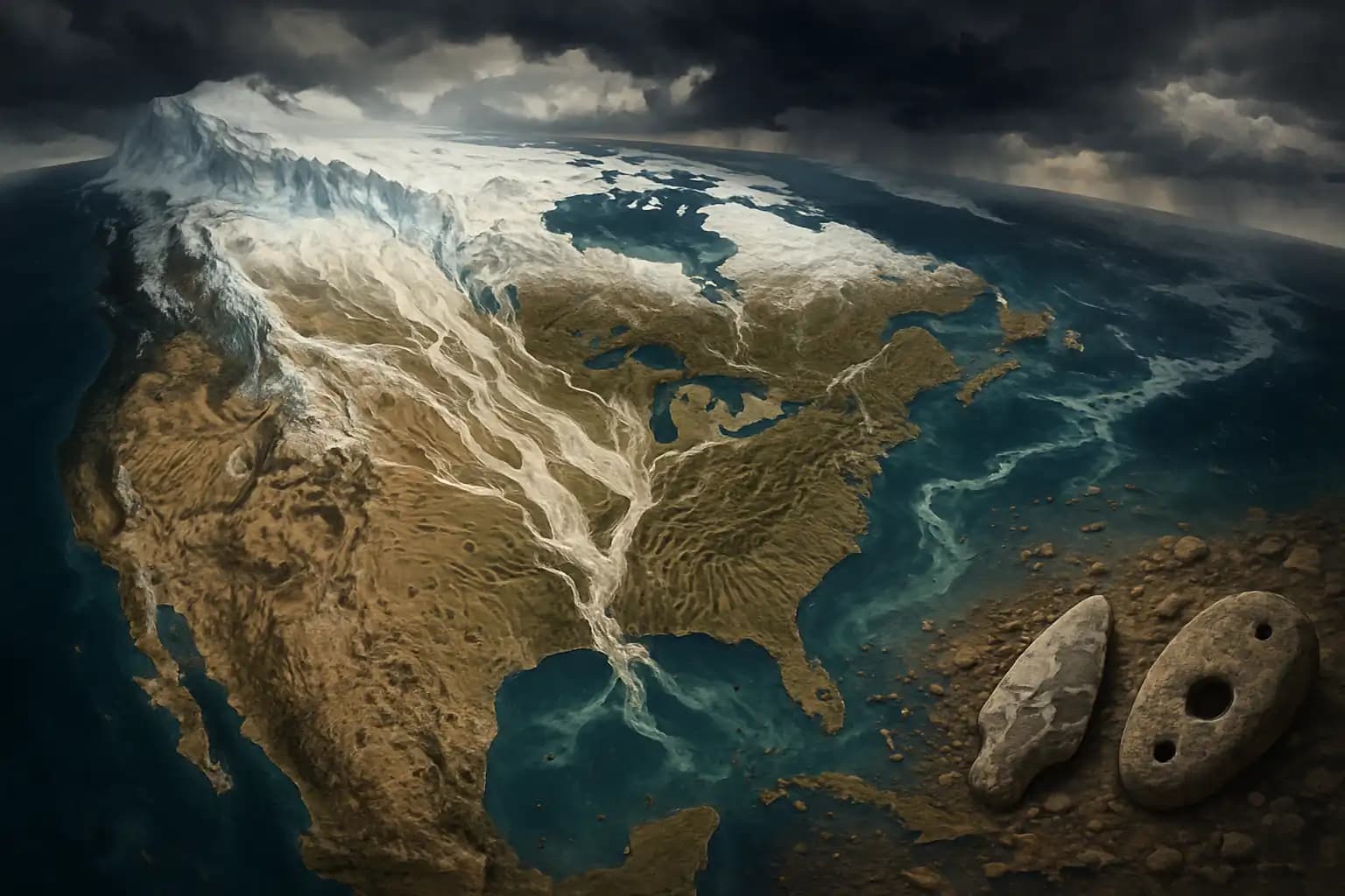
Mega Floods: The Violent Birth of American Landscapes
Glacial Lake Agassiz—once as large as all the Great Lakes combined—didn’t drain gracefully. According to Nature Geoscience, geologists now have proof of an outburst flood of astonishing magnitude that swept across the northern plains as the Ice Age came to a close. These rapid events unleashed hundreds of cubic kilometers of water in mere days, scouring the land and leaving enormous spillways, boulder fields, and channels reminiscent of today’s Channeled Scablands. Catastrophism—the once-controversial notion that Earth’s history is shaped by abrupt, violent events—is regaining popularity, rewriting the old uniformitarian dogma that defined 20th-century education.
Satellite imagery combined with sediment analysis reveals scars that simple rivers could not have created—not even in millions of years, and certainly not through “gradual” erosion. Geologists, with an eye for disaster, identify megaflood features often mistaken for slowly formed valleys or benign badlands. Once recognized, these signs serve as hard evidence of cataclysmic transformation.
Glacial Lake Agassiz and the Legacy of Outburst Floods
The draining of Glacial Lake Agassiz ranks among the most significant flood events in Earth’s modern narrative. ScienceDirect explains that the Agassiz flood may have triggered the Younger Dryas, a return to glacial cold that halted post-Ice Age warming for centuries. Water surged north and east, carving colossal spillways, depositing extensive gravel beds, and altering drainage routes across the continent. The scale was tremendous: water levels in Agassiz plummeted hundreds of feet within days, and the sedimentary record reveals an abrupt, transformative event rather than a prolonged transition.
This matters beyond just the interests of “rock nerds.” Catastrophic floods act as a geological reset button: rivers, lakes, and coastlines shifted locations overnight. Habitats vanished instantly, and archaeological sites—perhaps even entire lost settlements—disappeared beneath new landscapes. This phenomenon resembles civilization’s reset, discussed in doomsday inquiries and after cataclysmic reset cycles. Like the secrets concealed in the shadowy depths beneath Egyptian pyramids, much of America’s prehistory remains hidden, out of mind, or buried beneath miles of glacial till.
The Drumlin Dilemma: Erosion Features That Defy Gradualism
Certain features, such as drumlins and giant flutings—elongated, streamlined hills found across the upper Midwest and Northeast—puzzle even experienced geologists. Traditional theory suggested they formed over thousands of years due to ice flow. However, new models and field data propose that many emerged as ice sheets receded and catastrophic floods swept the land. These streamlined shapes indicate the flow direction of torrents, not the slow crawl of glaciers. Debates about the role of megafloods in shaping drumlins, explored in research on Agassiz and other proglacial lakes, signify a major shift in geomorphology. The evidence for these sudden, high-energy floods—especially in spillways and erosional features detailed by Carleton research—compels us to rethink the timing, formation, and reasons behind these landforms.
This blurs the lines between catastrophic folklore and contemporary science. The debate pitting gradual change against sudden disaster is just as vivid in geology as in discussions about abrupt shifts in civilization or even technology-driven existential risks.
Buried Prehistory: Cataclysm, Archaeology, and the Limits of Conventional Wisdom
If America was indeed sculpted suddenly and violently, what does that imply for early human settlements, lost river valleys, and vanished lakes? New voices in geoarchaeology advocate skepticism toward oversimplified timelines. They warn that entire eras—possibly featuring lost cultures—were swept away in chaos. Debris flows, till sheets, and underwater archaeological sites bear testimony to a world lost in translation, inviting comparisons to whole continents erased by time’s cataclysms.
The future of earth science will rely not on comforting narratives but on our readiness to confront the turbulent, dynamic truth beneath the surface. Keep questioning the dogma, and watch for new scans, analyses, and disruptive evidence that redefine our understanding of the past—an area of focus for Unexplained.co, where no stone is left unturned and every geological paradox poses a challenge to established narratives.